We hit the tip top of America today. In fact, we hit it twice.
Hit 1: the terminus of I -75 in Sault Ste. Marie. The highway becomes the International Bridge, which is American and Canadian territory simultaneously (or no-man’s-land?). We took the last exit into America.


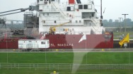
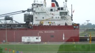
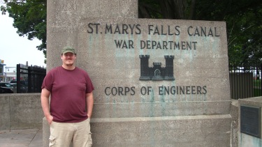 Our destination was the “Soo” Locks over St. Mary’s River, brought to you by the Army Corps of Engineers! The Locks move boats up and down the 21-foot rapids that exist at the connection between Lake Superior and Lake Huron. It’s basically a big dam: boat goes into the Lock, a door opens so water can flood into (or out of) the Lock, and then the boat sails out in higher or lower water, no careening down rapids required. Like this:


Then we headed out west along the coast toward Hit 2, with a stopover at the Point Iroquois Lighthouse. This lighthouse isn’t in use anymore, and you can climb all the way up into the (spider-infested) tower. But they had really detailed 1950’s recreations inside the station house, when it was last in regular use.


Hit 2: Whitefish Point
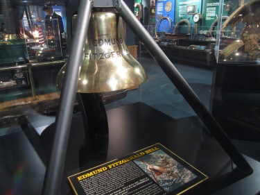
 About an hour northwest of Sault Ste. Marie is Whitefish Point, which hosts another lighthouse, a pre-Coast-Guard lifesaving station, and the Great Lakes Shipwreck Museum. This was a really fascinating (if slightly offputting) visit. They document shipwrecks on the lakes since 1812, many clustered within a few miles of Whitefish Point. A lot of early wrecks were the result of boats hitting other boats — the Royal Mail steamers had absolute right-of-way and took out like 20 other ships throughout the years 😛 Since ship-to-ship and ship-to-shore radio systems were developed it’s mostly been storms. Their largest exhibit focuses on the Edmund Fitzgerald sinking in 1975. They have the original bell which was recovered from the wreck, and the “newt suit” which the diver used to cut the bell free.

The lighthouse itself is still is use by the Coast Guard, so it was highly off limits, but the keeper’s house is set up as a 1920’s reconstruction which shares the life of the longest full-time keeper, who served there from 1901 – 1931. And what artifact would any 1920’s military wife (who ran their weather station for an extra $10 a month!) have to make life more bearable in the isolated wilderness of Whitefish Point? A Singer 27 sewing machine in a treadle table! I was looking for it every room, and behold! It appeared! 😛 nerd-out moment.


Arguably the coolest exhibit was the lifesaving service station, probably because there was a docent explaining everything. Before the Coast Guard, lifesaving stations were located every 10 miles around the lake shore with teams of 8 men who trained to rescue sailors gone aground. Three times every night a man walked halfway to the next station, traded a marker with the man from that station, and then walked back. Before radio (this service ended in 1915 with the formation of the Coast Guard) most ships would travel within several hundred yards of the shoreline, so in storms they were more likely to get trapped in the rocks than actually sink. So the lifesaving service teams rescued the sailors with life boats or beach carts with a cannon to shoot a pulley system over to the ship. Their main rule was never to stop until everyone was accounted for, dead or alive. They saved some 50,000+ people from the late 1800s through 1914, and only lost about 200.


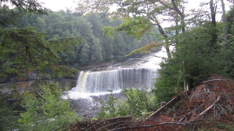
The loop back home brought us past the Tahquamenon State Park, and we stopped at the Upper Falls. The road signs for this were not very helpful: TQUF 10 miles. But WORTH IT. Wow.


Tomorrow: Mackinac Island!


